Kirby Muxloe Castle
As part of the former deer park associated with the castle and having been included within the same ownership until the first half of the 20th Century, the site does have historic association with the castle. The northern part of the site also provides an area of open space to the south of the castle, evoking the sense of the historic rural setting of the castle.
The area of land to the north between the site and the castle would remain undeveloped, thus a substantial element of open space will be retained, as will the historic rural setting.
The landform and vegetation in the north-west of the site restrict visibility of Kirby Muxloe castle, with the central and southern fields having limited to no visibility of the castle. Whilst they do have some historic association with the castle as set out above, it is less readily appreciable due to the lack of intervisibility. These areas of the site therefore make a lesser contribution to the significance the castle derives from the site and would be less sensitive to development.
The development layout has been designed and considered sensitively taking account of the castle context and mitigation has been embedded within the overall design to ensure that the parts of the site most intimately linked to the setting of the castle remain free from development. A high-quality landscape scheme has also been developed which will provide additional screening.

The setting of Kirby Muxloe Castle has been given very careful consideration in the design of the proposed development.
Kirby Fields Conservation Area
The site constitutes part of the limited setting of the conservation area and contributes minimally to the significance derived from this setting. There would be no direct impacts to the conservation area from the proposals, with the proposed change east of the designated area’s boundary. There is no designed or coincidental association between the site and the conservation area.
The eastern edge of the conservation area is screened from the site by a close-bordered fence and vegetation within the site and in the gardens of the properties closest to it. Beyond this to the west is the later post-war housing focused on the cul-de-sacs of Holt Drive, Rosedene Close and Walton Close. This area of the conservation area has been established as making less contribution to the character and appearance of the conservation area.
The proposed development is assessed as resulting in less than substantial harm through an element of erosion to the conservation area’s limited wider rural setting which make a minimal contribution to its significance. The level of harm is assessed to lie at the lowest end of less than substantial which would be significantly outweighed by the benefits of the proposal.
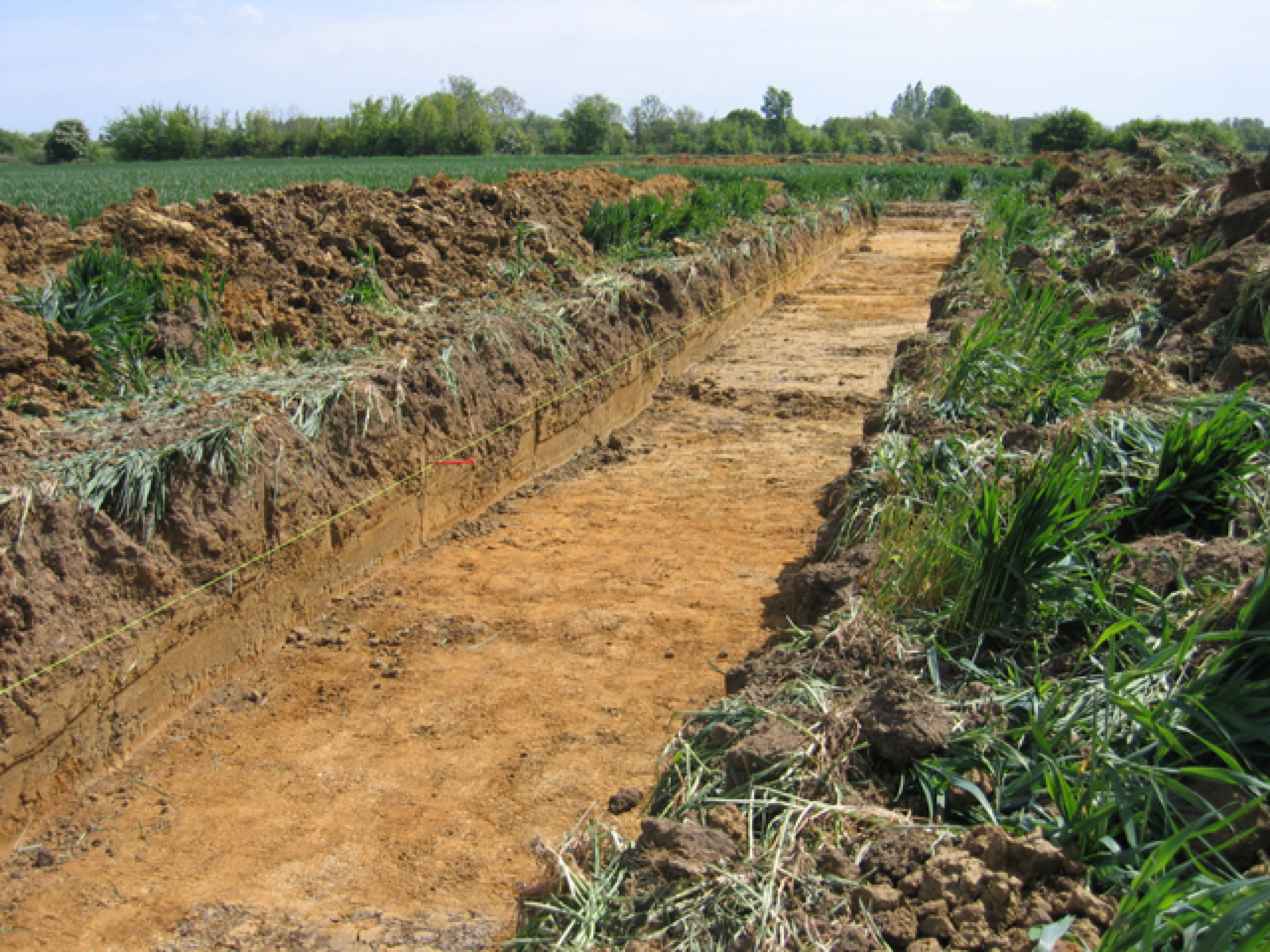
Archaeology
A detailed geophysical survey has been carried out for the site which has confirmed that no significant remains survive within the site. Notwithstanding this, to accord with current planning policy and guidance, the site could be subject to a programme of trial trenching secured by way of a suitably worded planning condition.

A historical map showing the site's built context in 1885

A historical map showing the site's built context in 1964